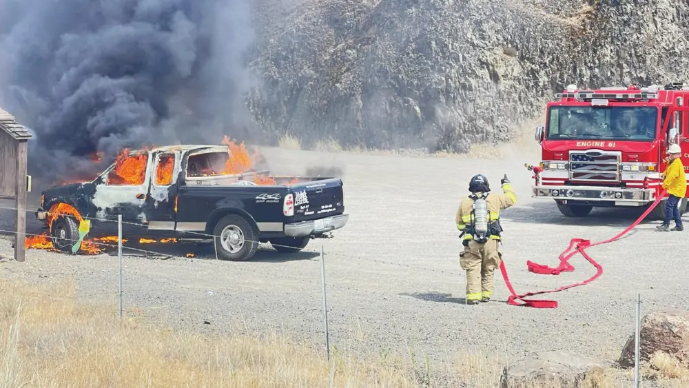
The Williams Creek Fire, 5 miles west of Orogrande, is at 16,084 acres and now 55% contained.
Today is the Team’s final day and its members will travel to their home units tomorrow. All aircraft and hand crews will be demobilized from the fire by this evening. Three engines will also be demobilizing.
Many of the resources leaving the Williams Creek Fire will be reassigned to other active fires across the Northern Rockies. Two engines will remain on site, patrolling and monitoring fire activity. While no aerial resources will be assigned directly
to the fire tomorrow, several aviation resources located in Grangeville will be available if needed. The fire has shown very little heat in the past few days; but the larger, dry logs may produce puffs of smoke as they smolder until fully consumed.
As the fire continues to smolder along the 233 and 311 Roads, standing dead trees (“snags”) remain a dangerous hazard and could fall without notice. Crews and heavy equipment are working to remove these trees and clear the roadways, coordinating with the county road department to determine necessary repairs. The roads into Orogrande remain closed to the general public, as this area is within the Forest Area Closure.
The Forest implemented an expanded Area Closure on 9/12, due to the fire’s location and its high potential for movement given the dry fuels and recent weather conditions. The closure remains in effect and will be re-evaluated, based on fire activity conditions and associated firefighting and repair efforts.
The Twin Lakes Fire, east of Twin Lakes and Hagen Creek, is still 992 acres and now 75% contained.
The Twin Lakes Fire will be monitored by local Forest Service resources, as needed. The wildfire module completed structure protection measures and has been demobilized.
WEATHER AND FIRE BEHAVIOR
The cool, wet weather pattern remains in the fire area, with increased cloud cover. Relative humidity levels hovered in the 60-70% range. Light precipitation fell off and on throughout the day. Similar weather conditions will linger, with a chance of scattered showers and isolated thunderstorms and additional widespread precipitation through the weekend and into early next week. Wetting rains are likely, with associated lightning, small hail, and gusty winds to 30 mph. Due to the weather,
limited fire behavior is expected. However, smoke will likely remain visible as larger fuels continue to smolder.
CLOSURES AND SPECIAL MESSAGES
Closures surrounding both fire areas are necessary to protect the safety and welfare of the public and provide for safe firefighting efforts and access. Specific closure information and maps are posted on Inciweb at https://inciweb.nwcg.gov/incident/8372/ as they are implemented.
The Twin Lakes Fire closure includes the following roads and trails:
OPEN:
NFSR 444 Gospel Road – open from junction with NFSR 221 to Moore’s Guard Station/Campground
CLOSED:
NFST 312 – North Moore’s Trail – closed from trailhead to MP 6.83/jct with NFST 383 Square Mountain
NFST 383 – Square Mountain Trail – closed from MP 6.64/jct with NFST 315 to MP 7.16/jct with NFST 312
NFST 315 – Kentucky Creek Trail – closed from trailhead/jct with NFST 313 to MP 7.71/jct with NFST 383
NFST 313 – Hump Trail – closed from MP 15.4/jct with NFST 384 to MP 18.1/jct with NFST 315
NFST 384 – Square Mtn. Spur Trail – closed from trailhead/jct with NFST 383 to MP 1.37/jct with NFST 313
NFST 383 – Square Mountain Trail – closed from trailhead/jct with NFSR 444 to MP 1.59/jct with NFST 384
NFSR 444 – Gospel Road – closed from MP 11.57 at Moore’s Campground to end of road at Square Mountain Lookout
The Williams Creek Fire closure includes the following roads and trails:
OPEN:
Idaho Highway 14 – South Fork Highway: Open from MP 35.2 to MP 43 at Elk City Township Boundary. NFSR 222 –
Dixie Road: Open from Forest Boundary at MP 0.95 to jct with NFSR 1800 at MP 7.36.
CLOSED:
NFSR 1800 – 66 Creek Road: Closed from junction with NSFR 222 to jct with NSFR 9803.
NFSR 9803 – North Wheeler Mtn. Road: Closed from jct with NSFR 1800 to jct with NSFT 508.
NFST 508 Porter Trail: Closed from jct with NSFR 9803 to jct with NSFT 207.
NFST 207 Moose Butte Trail: Closed from jct with NST 508 to hydrologic divide located in T26N R8E section 9 NW 1/4.
NFST 205 Columbia Ridge Trail: Closed from hydrologic divide/ridge located in T26N R8E section 20 NW 1/4. to junction
with NSFR 233 near Orogrande Summit.
NFSR 233 Crooked River Road: Closed from jct with NSFT 205 to jct with NSFR 233C.
NFSR 233C Little Buffalo Road: Closed from jct with NSFR 233 to jct with NSFT 313.
NFST 313 Hump Trail: Closed from jct with NSFR 233C to jct with NSFT 300.
NFST 300 Boundary Peak Trail: Closed from jct with NSFT 313 to hydrologic divide/ridge located in T27N R6E section 17
NW 1/4.
NFST 806 20 Mile Lake Trail: Closed from hydrologic divide/ridge located in T27N R6E section 5 NW 1/4 to jct with
NSFT 414.
NFST 414 20 Mile Creek Trail: Closed from jct with NSFT 806 to jct with NSFT 930.
NFST 930 Desperation Mine Trail: Closed from jct with NSFT 414 to jct with NSFR 492.
NFSR 492 Santiam Sourdough Road: Closed from jct with NSFT 930 to beginning of road/junction with Idaho Hwy 14.