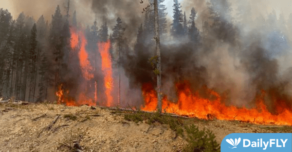
KAMIAH, Idaho—Local weather forecasts seem to agree that there is more precipitation on the way for North-central Idaho this week. Cooler temperatures combined with precipitation last week to provide a much-welcomed speed bump to the local fire season. Forecasts are calling for another round of rain showers over the next few days which would greatly help the overall fire effort across the forest. Fire activity and perimeter growth have been slowly decreasing recently, and this trend is expected to continue under the current weather patterns.
The latest fire information can be found at our Fire Information Webpage (http://bit.ly/NPCFireInfo), or by calling the Nez Perce-Clearwater National Forests’ Fire Information Line at 208-935-6134 Monday through Friday between 8:00 am and 4:00 pm PDT. For the latest Nez Perce-Clearwater National Forests closure information, please visit https://bit.ly/NPClwNF-AlertsNotices.
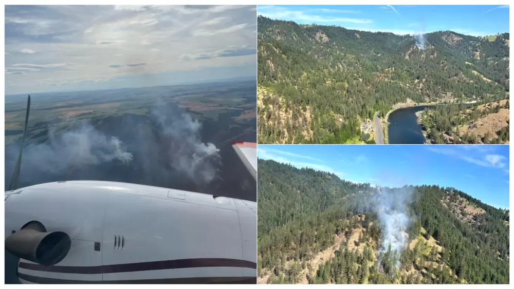
Current Fires on the Nez Perce-Clearwater NF as of reporting time:
Full Suppression Strategy Defined: This strategy implies that a fire will be “put out” as efficiently and effectively as possible while providing for both firefighter and public safety.
Point Protection Strategy Defined: A wildfire response strategy which protects specific assets or highly valued resources from the wildfire and may also utilize features such as past wildfires or prescribed fires, roads, rivers, etc. to ultimately prevent the fire from impacting more distant values.
*Special Note: This will be last report unless significant activity occurs for fires marked with an asterisk.
Salmon River Ranger District
Fires with a Full Suppression Strategy
The Swan and Chisum Trail Fires were both fully suppressed and declared out over the weekend.
Fires with a Point Protection Strategy
The Twin Lakes Fire is located about 23 miles Southwest of Elk City, ID within the Gospel Hump Wilderness. Fire activity and growth have been very minimal. This fire is still estimated to be just under 1000 acres. There is still currently a closure order in place for the Square Mountain area, but Fire Managers are looking at reducing or rescinding the closure based on weather forecasts for this week.
Moose Creek Ranger District
Fires with a Point Protection Strategy
The Glover Fire is located about 12 miles East of Lowell, ID and five miles East of Coolwater Lookout. Fire size remains estimated at about 320 acres after recent infrared flights.
The Little Copper Fire is located about 24 miles Southeast of Lowell, ID and six miles to the Southeast of Indian Hill Lookout. Fire size is approximately 747 acres still. Fire activity and growth has been minimal recently.
The Rackliff Fire is located approximately three miles Northeast of Fenn Ranger Station. Fire size is about 15 acres.
North Fork Ranger District
Fires with a Point Protection Strategy
The Caledonia Fire is approximately 18 miles Northeast of Kelly Forks Work Center. Fire size is now estimated at 1,469 acres. Currently, fire activity has been minimal with creeping and smoldering fire behavior. A closure order is still in place for the following:
- NFSR #715 Pot Mountain Ridge Road, closed from the junction with NFSR #320 to the junction with the NFST #233 at the St. Joe Divide.
- NFSR #723 Headwaters Road, closed from the junction with NFSR #715 to the end of the road at Clearwater Mine.
The Lower Twin Fire is located about 20 miles Northeast of Headquarters, ID in brush and timber. This fire is estimated to be 1,856 acres in size with minimal fire activity or growth. Closure orders are still in place for the following trails:
- NFST #396 Black Mountain, closed from the junction of NFSR #247 Beaver- North Fork Road to its end at Black Mountain Lookout.
- NFS Trail #685 Black Lake, closed from the junction of NFST #396 Black Mountain to its junction with NFST #399.
- NFST #399 Nub Trail, closed from the junction of NFSR #247 Beaver- North Fork Road to its junction with NFST #65 Heart Pass.
- NFST #95 Isabella Creek, closed from the trailhead at Isabella Point Camp on NFSR #705 Isabella Creek to its junction with NFST #399 Nub Trail.
- NFST #96 Elmer Creek, closed from the junction of NFST #95 Isabella Creek to its junction with NFST #240 Smith Ridge.
- NFST #240 Smith Ridge is closed from the Smith Ridge trailhead on NFSR #700 Smith Ridge to its junction with NFST #65 Heart Pass.
- NFST #65 Heart Pass is closed from its junction with NFST #240 Smith Ridge to its junction with NFST #399 Nub Trail.
The Wallow Fire is located about 25 miles Northeast of Headquarters, ID. Fire size is about 430 acres. Fire activity and growth remain minimal. Two segments of trail remain closed due to this fire:
- NFST #101 is closed from its junction with Forest Service Road #710 to its junctions with FSR #5371.
- NFST #268 Lost Pete Trail is closed from its junction with FSR #247 to the trail’s end.
The *Bruin Hill Fire is located about 20 miles Northwest of Powell, ID within about 3.5 miles of the Idaho/Montana border. Fire size remains about ten acres.
The Deep Creek Fire is located about 14 miles Northeast of Headquarters, ID. Fire size is now estimated at 484 acres and a trail closure remains in place:
- NFST #617 Cave Point Trail is closed in its entirety.
The *Wolf Fire is located 28 miles Northeast of Headquarters, ID. Fire size is about 16 acres with continued minimal fire activity. The fire is within an old burn scar.
The *Cold Springs Fire is 25 miles northeast of Headquarters, ID. Fire size is about nine acres with continued minimal fire activity.
The Isabella Point Fire is approximately six miles North of Canyon Work Center. Fire size is about 425 acres with minimal fire activity.
The *Heart Peak Fire is approximately six miles North of Canyon Work Center. Fire size is still about 42 acres with no growth, as it is being held up on terrain features.
The Wash Fire is approximately three miles North of Canyon Work Center. Fire size is estimated to be about 365 acres. Fire activity continues to be minimal.
The *Black Mountain Fire is approximately three miles North of Canyon Work Center. Fire size is estimated at 16 acres with minimal fire activity. Natural barriers appear to be preventing fire growth.
The *Cook Fire is approximately ten miles South of the Kelly Forks Work Center. Fire size is roughly 22 acres with minimal fire activity.
Lochsa-Powell Ranger District
Fires with a Point Protection Strategy
The Huckleberry Fire is located about four miles Southeast of the Lochsa Historical Ranger Station. Fire size remains estimated at 456 acres. Currently, there are no closures in place due to this fire; however, caution signs have been posted at the #211 and #220 trailheads out of Wilderness Gateway Campground to warn of the fire within the area.
The *Castle Fire is located about 28 miles Northeast of Lowell, ID. The current size is still around 630 acres. No growth or activity being reported.
The Van Camp Fire is located about 15 miles Northeast of Syringa, ID. This fire is estimated to be 2,750 acres after a recent infrared flight and continues to impact several roads and trails. Current closures to trails and roads remain in place:
· NFST #705 Upper Deadman Trail, closed from junction with NFSR #483 to junction with NFST #192
· NFST #16 Van Camp Trail, closed from junction with U.S. Highway 12 to end of trail.
· NFSR #481 Van Camp Rd, closed from junction with NFSR #483 to end of road.
· NFSR #481-S, closed from junction with NFSR #481 to end of road.
· NFST #142 Deadman Ridge Trail, closed from the trailhead at Glade Creek Campground on Highway 12 in its entirety.
· NFST #116A Frenchman Butte Trail, closed from the trailhead on NFSR #483 in its entirety.
· Road NFSR #5541 West Deadman Road, closed from the gate to the end of the road.
· NFSR #5544 Brush Hill Road, closed from the junction with NFSR #5542 to the junction with NFSR #5546.
· NFSR #5546 Lower Deadman Road, closed from the junction with NFSR #5544 to the end of the road at the junction with NFST #142.
The Fire Creek Fire is located within the Coolwater Rx prescribed fire project boundary. This fire is around 387 acres with minimal activity or growth recently.
The Post Office Fire is located about 14 miles Northwest of Powell, ID. This fire is approximately 2,260 acres in size. Fire activity continues to be moderate with isolated tree torching and short-range spotting observed. Aerial and ground resources continue to oversee the fire. Closures remain in place for the following:
- NFST #919, Closed from junctions with U.S. Highway 12 to end of trail.
- NFSR #500 Lolo Motorway, Closed from Saddle Camp to Cayuse Junction.
- NFSR #566 Doe Creek Road, Closed from junctions with NFSR #108 to end of road.
The Howard Creek Fire is located about 18 miles West of Powell, ID. This fire is approximately 124 acres in size with moderate fire activity. Closures are the same as the Post Office Fire. Aerial and ground resources continue to oversee the fire.
The South Fork Fire is about 18 miles East of Powell Ranger Station. Fire size is about 1,386 acres. Aerial and ground resources continue to oversee the fire.
The Ranger Fire is located 14 miles East of Powell, ID. Fire size is estimated to be about 299 acres. Fire activity remains moderate. Aerial and ground resources continue to oversee the fire.
The Warm Springs Fire is located about 11 miles South of Powell, ID within the Selway-Bitterroot Wilderness. Fire size is about 4,683 acres. Fire activity has been moderate. Aerial and ground resources continue to oversee the fire. Closures are currently in place for the following:
- NFST #7 Tom Beal Creek Trail, closed from the trailhead at Tom Beal Park to the junction with NFST #24 (Wind Lakes Trail).
- NSFT #24 Wind Lakes Trail, closed from the junction with NFST #7 (Tom Beal Creek Trail) to the junction with NFST #89 (Saturday Ridge Trail).
- NSFT #45 Friday Pass Trail, closed from the junction with NFST #24 and NFST #89 (Wind Lakes and Saturday Ridge Trails) to trailhead at Kooskooskia Meadows.
The Savage Ridge Fire is located about five miles Southeast of Powell Ranger Station. Fire size is now about 23 acres with most of that growth happening over the weekend.
The *Gold Meadows Fire is located about eight miles Northeast of Wilderness Gateway Campground. Current estimated size remains at about 20 acres.
The Frenchman Butte Fire is located about 16 miles Northeast of Syringa, ID. Fire size is now estimated to be about 110 acres. Fire activity has been moderate in recent days. Fire managers still do not anticipate any impacts to roads or trails.
Red River Ranger District
Fires with a Point Protection Strategy
The Williams Creek Fire is located five miles West of Orogrande, ID in the Gospel Hump Wilderness. Fire size is approximately 16,084 acres, and the fire area has received significant precipitation over the last week. As of 9/17/22, a Type 4 Incident Commander from the Red River Ranger District has assumed command of this fire from Northern Rockies Team #5. A closure order remains in effect, but Fire Managers are looking at options to reduce or rescind this closure order.
The 3 Prong Fire is located 14 miles Northeast of Red River Work Center. Fire size is estimated to be about 4,645 acres. The fire has impacted portions of the NFSR #285. A combination of crews and equipment continue working to keep the road open for public access.
The Lynx Meadows Fire is located about 20 miles East of Elk City, ID. A recent infrared flight mapped the fire at 1,208 acres. The fire is burning near the junction of NFSR #285 and NFSR #357. A closure order remains in effect, but Fire Managers are looking at options to reduce or rescind the trail closure.
- NFST # 534 Lynx Creek, closed from the junction with Forest Road #285 to the end of the trail at the junction of Forest Road #565.
The *Bleak Fire is located roughly 20 miles Northeast of Dixie, ID and 22 miles Southeast of Elk City, ID. The fire is less than 1/10 acre with minimal fire activity.
The *Rhett Fire is located about five miles Southeast of Dixie, ID, within the 2021 Dixie Fire burn scar. Fire size is about 1/10 acre with minimal fire activity.
The *Rainey Fire is located approximately 18 miles Southeast of Elk City, ID. Fire size is about 1/2 acre with minimal fire activity.
The Tamarack Fire is located about 13 miles Northeast of Elk City, ID. Fire activity has been minimal, and current fire size is still estimated at about 251 acres. There are no impacts to trails at this time, but the fire is burning near NFST #726.
The Elk Mountain Fire is located approximately 19 miles Northeast of Elk City, ID. Fire size is about 40 acres and has impacted the NFST #517, but recent activity has been minimal.