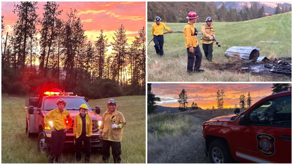
The Williams Creek Fire, 5 miles west of Orogrande is around 15,773 acres and is now 31% contained, however, The Forest implemented an expanded Area Closure on September 19, due to the fire’s location and its high potential for movement given the dry fuels and recent weather conditions. However, the Forest is working to expedite the rescission of the area closure due to the cooler and wetter weather.
Road closures may remain, depending on fire activity conditions and associated firefighting efforts. Crews continue to monitor fire activity and take action as needed to prevent the fire from progressing and to “mop-up” areas of residual heat. Many of the resources assigned will be available for reassignment in the coming days, given the rainy weather and moderated fire behavior. Crews will be removing structure protection equipment no longer needed.
Aerial support from helicopters was unavailable yesterday due to low visibility. Today, an unmanned aerial system (“drone”) will be utilized to monitor fire activity along the northern flank and gather information on the fuels treatment project areas along the western edge. Additional aerial resources will remain at the ready if conditions allow.
As the fire continues to smolder along the 233 and 311 Roads, standing dead trees (“snags”) remain a dangerous hazard and could fall without notice. Crews and heavy equipment are working to remove these trees and clear the roadways, coordinating with the county road department to determine necessary repairs. The roads into Orogrande remain closed to the public, as this area is within the Forest Area Closure. The overnight infrared mapping flight was unable to fly due to weather.
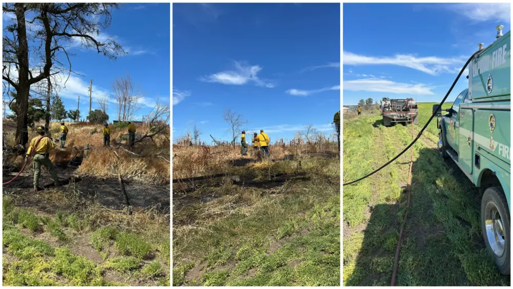
The Twin Lakes Fire, east of Twin Lakes and Hagen Creek is at 973 acres and 40% contained.
The fire module will monitor activity through today. If no additional fire activity is observed, the module will demobilize and return to its home unit. The overnight infrared mapping flight was unable to fly due to weather.
WEATHER AND FIRE BEHAVIOR
The Twin Lakes Fire area received up to 3⁄4 of an inch of rainfall yesterday. The Williams Creek Fire received about 1⁄2 an inch in the community of Orogrande. This precipitation led to a significant reduction in fire behavior. Relative humidity levels never dipped below 70% yesterday; readings are expected to remain around 40% today. Temperatures are predicted to be in the mid-50s.
Heavy fog will likely decrease visibility in the morning hours. Storms are expected throughout the day, with periods of brief heavy rainfall. More widespread precipitation is expected on Thursday, with even cooler and wetter weather come Saturday and Sunday. Snowfall in higher elevations is possible by early next week. With these conditions, fire behavior will be limited to creeping and smoldering.
CLOSURES AND SPECIAL MESSAGES
Closures surrounding both fire areas are necessary to protect the safety and welfare of the public and provide for safe firefighting efforts and access. Specific closure information and maps are posted on Inciweb at https://inciweb.nwcg.gov/incident/8372/ as they are implemented.
The Twin Lakes Fire closure includes the following roads and trails:
OPEN:
NFSR 444 Gospel Road – open from junction with NFSR 221 to Moore’s Guard Station/Campground
CLOSED:
NFST 312 – North Moore’s Trail – closed from trailhead to MP 6.83/jct with NFST 383 Square Mountain
NFST 383 – Square Mountain Trail – closed from MP 6.64/jct with NFST 315 to MP 7.16/jct with NFST 312
NFST 315 – Kentucky Creek Trail – closed from trailhead/jct with NFST 313 to MP 7.71/jct with NFST 383
NFST 313 – Hump Trail – closed from MP 15.4/jct with NFST 384 to MP 18.1/jct with NFST 315
NFST 384 – Square Mtn. Spur Trail – closed from trailhead/jct with NFST 383 to MP 1.37/jct with NFST 313
NFST 383 – Square Mountain Trail – closed from trailhead/jct with NFSR 444 to MP 1.59/jct with NFST 384
NFSR 444 – Gospel Road – closed from MP 11.57 at Moore’s Campground to end of road at Square Mountain Lookout
The Williams Creek Fire closure includes the following roads and trails:
OPEN:
Idaho Highway 14 – South Fork Highway: Open from MP 35.2 to MP 43 at Elk City Township Boundary. NFSR 222 –
Dixie Road: Open from Forest Boundary at MP 0.95 to jct with NFSR 1800 at MP 7.36.
CLOSED:
NFSR 1800 – 66 Creek Road: Closed from junction with NSFR 222 to jct with NSFR 9803.
NFSR 9803 – North Wheeler Mtn. Road: Closed from jct with NSFR 1800 to jct with NSFT 508.
NFST 508 Porter Trail: Closed from jct with NSFR 9803 to jct with NSFT 207.
NFST 207 Moose Butte Trail: Closed from jct with NST 508 to hydrologic divide located in T26N R8E section 9 NW 1/4.
NFST 205 Columbia Ridge Trail: Closed from hydrologic divide/ridge located in T26N R8E section 20 NW 1/4. to junction
with NSFR 233 near Orogrande Summit.
NFSR 233 Crooked River Road: Closed from jct with NSFT 205 to jct with NSFR 233C.
NFSR 233C Little Buffalo Road: Closed from jct with NSFR 233 to jct with NSFT 313.
NFST 313 Hump Trail: Closed from jct with NSFR 233C to jct with NSFT 300.
NFST 300 Boundary Peak Trail: Closed from jct with NSFT 313 to hydrologic divide/ridge located in T27N R6E section 17
NW 1/4.
NFST 806 20 Mile Lake Trail: Closed from hydrologic divide/ridge located in T27N R6E section 5 NW 1/4 to jct with
NSFT 414.
NFST 414 20 Mile Creek Trail: Closed from jct with NSFT 806 to jct with NSFT 930.
NFST 930 Desperation Mine Trail: Closed from jct with NSFT 414 to jct with NSFR 492.
NFSR 492 Santiam Sourdough Road: Closed from jct with NSFT 930 to beginning of road/junction with Idaho Highway 14.
- “Percent completion” of objectives more accurately captures and reports the specific amount of work accomplished on the
ground to manage fire spread and reduce the negative impacts to communities, infrastructure, and other identified values. By
using percent completion of objectives, fire managers can illustrate how they are progressing with the accomplishment of
objectives that have been identified and prioritized.
As a comparison, “containment” implies firelines around the entire perimeter, directly next to the fire’s active edge.