


Size: 20,922 Acres
Start Date: July 15, 2024
Cause: Under investigation
Location: SW of Clarkston, 1 mile west of Hwy 129 and Grand Ronde River intersection
Containment: 35%
Personnel: 483
Fire Strategy: Full suppression
Resources Assigned: 10 crews, 3 helicopters, 33 engines, 12 water tenders, 14 heavy equipment
There will be a virtual community meeting for the Cougar Creek Fire tonight at 7:30 PM on the Cougar Creek Fire Facebook Page; the meeting will also be recorded and posted on that page. No login or Facebook account is required. You can send questions in advance to [email protected]
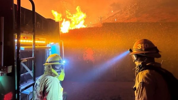
Operations: Firefighters carefully initiated firing operations along FSR 43 yesterday, burning west from the NW corner of the fire perimeter to add depth to containment lines along the road. The aerial UAS platform with a plastic sphere dispenser (PSD) was also used for precision firing in the steep terrain where crews could not safely work. Fire crews also started firing operations north from Saddle Butte late yesterday afternoon but needed to stop the operation later in the evening due to changing conditions and limited resources. There is still a pocket of interior heat burning in the Medicine Springs drainage. Heavy and medium helicopters used water bucket drops to support the firing operation and cool hot spots around the fire perimeter yesterday. Helicopters on the Cougar Creek Fire also assisted the nearby Wolf Fork Fire as well, dropping a combined total of 29,000 gallons of water across both fires.
Favorable weather conditions are a driving factor in this week’s fire suppression strategy to prevent the fire from entering the Wenaha-Tucannon Wilderness. Yesterday’s winds pushed the flames from the firing operations back towards the fire interior. Firefighters today will focus on extending the recent firing operations along FSR 43 westward to the junction of FSR 40 and the Kelly Camp Spur. Given favorable conditions, firefighters will continue firing operations near Wickiup Campground and around the northwestern corner of the fire southward down FSR 40 toward the Cabin Saddle campground.
Evacuations and Closures: Forest closure descriptions and maps are available online on the Umatilla National Forest closure website. In Washington, evacuation notices are posted on the Asotin County Sheriff website and Asotin County Emergency Management Facebook website. Grande Ronde Road is closed from Troy, Oregon, to the Highway 129 junction in Washington. A level 2 evacuation remains in effect for all of Grouse Flat. The TFR remains in effect: https://bit.ly/4duptei. Drone activity is prohibited under the TFR as firefighting aircraft cannot fly with unauthorized drones present. Please respect road and area closure orders and use extra caution while driving for your safety as well as our firefighters.
Weather and Smoke: Weak westerly flow today will keep conditions cool and dry, but on Friday the weather pattern will begin to change. Temperatures will be slightly warmer and drier as we enter an extended period of dry weather. Learn more about smoke at http://wasmoke.blogspot.com/.